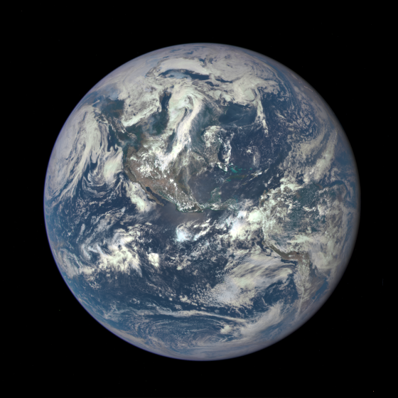
Space Swoon: Image of Earth from One-Million Miles Away
A Nasa camera on the Deep Space Climate Observatory (Dscovr) satellite – hanging in gravitational balance between the Earth and the sun – has returned its first view of the entire sunlit side of the planet from one million miles away.
The satellite was launched in February on a Space X Falcon 9 rocket and recently reached its planned orbit at the first Lagrange point or L1, where Nasa says it will be able to constantly take science-quality images of the entire sunlit face of the Earth.
Its first colour picture came from the spacecraft’s Earth Polychromatic Imaging Camera (Epic) and was made by combining three separate images to create a photographic-quality image, Nasa said on Monday as it released the photograph.
The camera on the spacecraft – a project championed by Al Gore when he was vice-president – takes a series of 10 images using different light filters from ultraviolet to near-infrared. The red, green and blue channel images were used in these Earth images, Nasa said, with the initial Earth images showing the effects of sunlight scattered by air molecules and giving them a characteristic bluish tint. Further processing would remove the atmospheric effects and reveal land features.
“This first Dscovr image of our planet demonstrates the unique and important benefits of Earth observation from space,” said Nasa administrator Charlie Bolden, a former astronaut. “Dscovr’s observations of Earth, as well as its measurements and early warnings of space weather events caused by the sun, will help every person to monitor the ever-changing Earth and to understand how our planet fits into its neighbourhood in the solar system.”
Eventually, when the satellite goes into full operation, new images are expected daily, Nasa has said. “The high quality of the Epic images exceeded all of our expectations in resolution,” said Adam Szabo, Dscovr project scientist at Nasa’s Goddard space flight centre in Greenbelt, Maryland. “The images clearly show desert sand structures, river systems and complex cloud patterns. There will be a huge wealth of new data for scientists to explore.”
Dscovr is a partnership between Nasa, the National Oceanic and Atmospheric Administration (NOAA) and the US air force aimed primarily at maintaining real-time solar wind monitoring capabilities used for “space weather alerts” – forecasts and tracking of activity such as solar flares and their impact on Earth.
Data will be used to measure ozone and aerosol levels in Earth’s atmosphere, cloud height, vegetation properties and the ultraviolet reflectivity of Earth, according to Nasa.


